click here to return to Wales home page
Glamorgan Heritage Coast


click to view photos of the area between Llantwit and St Donat's click to view photos of the area between Nash Point and St Donats click to view photos of the area between Southerndown and Nash Point click here to view photos of the area between Ogmore and Southerndown

click to fly to Llantwit Beach with Google Earth
to
click to fly to St Donat's with Google Earth
cliff and wave-cut platform near Llantwit beach
Glamorgan 35
large sea-caves in the cliffs backing the wave-cut platform
Glamorgan 41
sea anenome and limpet - part of the wide variety of of life in the many rock pools
Glamorgan 47
fresh water springs seeping from the limestone cliff have produced large scale growth of moss with a permanent and steady trickle
Glamorgan 60
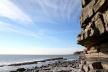
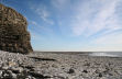
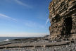
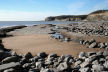
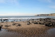
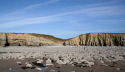
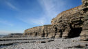
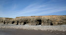
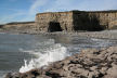
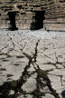
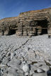
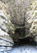
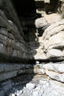
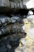
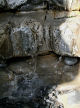
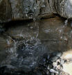
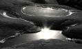
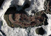
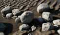
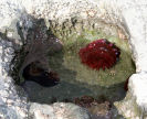
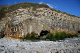
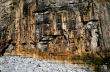
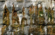
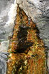
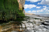
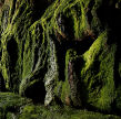
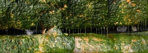
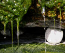
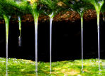
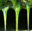
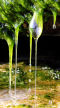
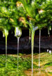
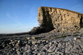
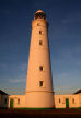
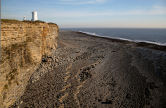
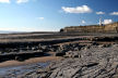
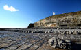
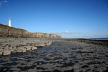
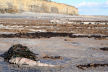
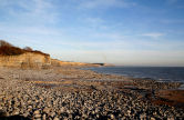
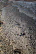
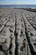
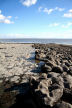
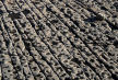
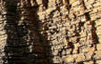
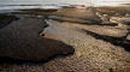
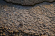
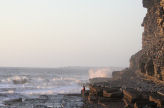
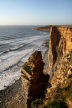
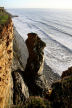
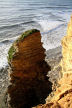
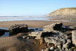
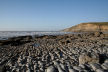
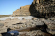
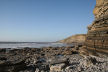
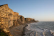
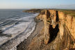
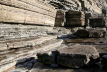
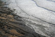
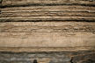
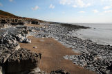
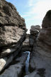
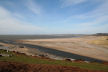
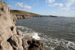
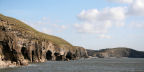
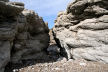
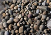
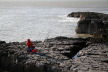
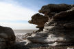
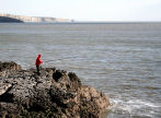
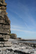
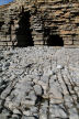
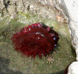
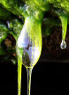
The Glamorgan Heritage Coast stretches for 14 miles, with distinctive cliffs, rocky wave-cut platforms and rock pools, sandy beaches, and fresh-water springs with colourful moss and algae growths. The 18 mile coast path can be walked in one go or in short sections.
click to get Google Earth click on any place name to fly to the location

Cliffs & foreshore
click to view photos of cliffs and the foreshore in the area between Llantwit and St Donats click to view photos of sea caves in the area between Llantwit and St Donats click to view photos of rock pools in the area between Llantwit and St Donats click to view photos of sea moss and algae in the area between Llantwit and St Donats
with one of the largest tidal ranges in the world, the sea comes in rapidly over the wave-cut platform right to the base of the cliff
Glamorgan 33
the large expanse of wave-cut platform is soon covered by rapidly rising tide
Glamorgan 31
the wave-cut platform has a number of distinct layers
Glamorgan 34
outgoing tide reveals stretches of sand beyond the rocky foreshore - sometimes smooth
Glamorgan 63
outgoing tide reveals stretches of sand beyond the rocky foreshore - sometimes rippled
Glamorgan 65

Caves & springs
    back to the top
the dip in the cliffs gives access from the cliff-top path to the foreshore, and marks the begining of the caves which lie to the left (West) and none to the right (East)
Glamorgan 39
wave-cut platform backed by cliffs and sea-caves
Glamorgan 40
an indication of the many sea-caves along this stretch of the coast
Glamorgan 38
the western-most cave on this stretch of coast, just after Tressilian Bay
Glamorgan 49
the sea-caves are formed by collapsing rock strata, here leaving behind a massive 'lintel'
Glamorgan 43
sea-caves in cliffs backing extensice wave-cut platform
Glamorgan 45
sea-caves in cliffs backing extensice wave-cut platform
Glamorgan 42
rock strata show very distinctly inside the caves
Glamorgan 56
softer rock strata are eroded more quickly, with fresh water springs emerging in some of them
Glamorgan 51
closer view of the fresh-water spring
Glamorgan 52
and still closer view of the fresh-water spring
Glamorgan 54
and closer view again of the fresh-water spring
Glamorgan 55
Rock pools
shallow rock pools in smooth, near-black rock
Glamorgan 36
small minimalist sea-water rock garden
Glamorgan 50
detail at the boundary between the rocky foreshore and the sand
Glamorgan 75
sea anenome and limpets
Glamorgan 46
small sea-water rock garden
Glamorgan 48

Moss & algae
    back to the top
moss and algal growth caused by fresh water seepage from the cliff East of St Donat's - scale shown by the figure in the cave mouth
Glamorgan 78
algal growth on the West-facing cliff face East of St Donat's
Glamorgan 94
in places the entire cliff is seeping with algae covering large areas
Glamorgan 73
pattern created by algae forming on line of small freshwater seeps drip down the cliff
Glamorgan 76
detail of algae formed on fresh water dripping from a point-source
Glamorgan 77
looking East at the moss covered cliff near St Donat's
Glamorgan 70
close up of part of the moss outcrop
Glamorgan 58
weak bedding has been eroded away and now drips continuously
Glamorgan 59
detail of fresh water dripping through the moss Glamorgan 62 detail of fresh water dripping through the moss
Glamorgan 25
detail of fresh water dripping through the moss
Glamorgan 12
detail of fresh water dripping through the moss
Glamorgan 79
detail of fresh water dripping through the moss
Glamorgan 61
back to the top
click to fly to Nash Point with Google Earth
to
click to fly to St Donat's with Google Earth
the cliff on the west side of Nash Point
Glamorgan 01
the 'tall' lighthouse built in 1832
Glamorgan 10
the 'tall' lighthouse at sunset
Glamorgan 09
rocky foreshore, southern cliff and 'short' lighthouse at Nash Point
Glamorgan 05
rock and sand foreshore looking West towards Nash Point lighthouses
Glamorgan 44
rocky foreshore looking West towards the low lighthouse at Nash Point
Glamorgan 95
rocky foreshore looking East towards the tall lighthouse at Nash Point
Glamorgan 96
sandy foreshore looking West towards the Nash Point lighthouses
Glamorgan 97
the ones which get away - don't always get away: dog fish trapped by seaweed wrapped around fishing line on the rocky foreshore East of St Donat's
Glamorgan 98
Glamorgan Heritage Coast - looking East across the rocky foreshore at Nash Point
Glamorgan 16
detail of rocky foreshore as seen from the top of the cliff
Glamorgan 07
detail of rocky foreshore  as seen from the top of the cliff
Glamorgan 14
down on the rocky foreshore East of St Donat's
Glamorgan 66
down on the rocky foresore East of St Donat's: different layers of limestone are eroded to give completely different 'finishes'
Glamorgan 71
Atlantic Collage, St Donat's
Glamorgan 08
detail of rocky foreshore as seen from the top of the cliff
Glamorgan 03
detail of rocky foreshore as seen from the top of the cliff
Glamorgan 04
detail of the western cliff at Nash Point
Glamorgan 02
detail of rocky foreshore as seen from the top of the cliff
Glamorgan 06
detail of rocky foreshore as seen from the top of the cliff
Glamorgan 13
 fossils are much in evidence
Glamorgan 67
 fossils are much in evidence
Glamorgan 68
 fossils are much in evidence
Glamorgan 69
THE FOG-HORN !!!! at Nash Point (at sunset)
Glamorgan 11
For information on the working light-house see the Trinity House web site.
back to the top
click to fly to Southerndown with Google Earth
to
click to fly to Nash Point with Google Earth
incoming tide at sunset
Glamorgan 21
cliff stack
Glamorgan 28
cliff stack
Glamorgan 22
cliff stack
Glamorgan 23
Southerndown beach at low tide
Glamorgan 18
'cobbles' of the wave cut platform at Southerndown
Glamorgan 19
wave-cut platform and pebble beach at base of cliff, Southerndown
Glamorgan 20
wave-cut platform and pebble beach at base of cliff, Southerndown
Glamorgan 24
towards Nash Point as the sun sets
Glamorgan 26
sharp arrete in the cliffs towards Nash Point
Glamorgan 27
cliffs and cliff stack looking back towards Southerndown
Glamorgan 29
detail of the lower cliffs at Southerndown
Glamorgan 17
incoming tide over sand-covered wave-cut platform
Glamorgan 30
rock strata in lower cliff at Southerndown, Glamorgan Heritage Coast
Glamorgan 32
back to the top
ckick to fly to Ogmore with Google Earth
to
click to fly to Southerndown with Google Earth
Ogmore is the eastern extremity of the limestone cliffs and wave-cut platform
Glamorgan 83
the rock is sculpted by wave action
Glamorgan 87
dancing mussels
Glamorgan 92
 fossils are much in evidence
Glamorgan 90
the Ewenny Estuary at Ogmore marks the break in the Glamorgan Heritage Coast between the limestone cliffs to the East and the extensive beaches and sand dunes to the West
Glamorgan 80
looking East along the limestone cliffs as far as Nash Point in the far distance
Glamorgan 82
the cliffs and caves looking towards Southerndown: the tide comes to the base of the cliffs well before high tide
Glamorgan 84
the low cliffs are much sculpted by wave action
Glamorgan 86
a wide variety of well-rounded pebbles is found along this stretch of the Glamorgan Heritage Coast
Glamorgan 89
the low cliff tops are popular with fishermen around high tide
Glamorgan 81

back to the top
lower cliffs sculpted by wave action
Glamorgan 85
the low cliff tops are popular with fishermen around high tide
Glamorgan 88
 fossils are much in evidence
Glamorgan 91
mussels cram into surface cracks in the limestone
Glamorgan 93


  site map